(ISSN 2300-1496)
(ISSN 2300-1496)
(ISSN 2300-1496)
(ISSN 2300-1496)

(ISSN 2300-1496)

(ISSN 2300-1496)
(ISSN 2300-1496)
The first issue, No. 1
The second issue, No. 2
The first issue, No. 1 (2019)
Agnieszka Bitner ![]() , Urszula Litwin
, Urszula Litwin ![]() , Wiktoria Biłko
, Wiktoria Biłko
A comparative anaLysis of real estate property markets in the cities of Cieszyn and Český Těšín
DOI: http://dx.doi.org/10.15576/GLL/2019.1.7
The article presents a comparative analysis of real estate markets in the cities of Cieszyn and Český Těšín. For almost 100 years these two cities have been divided by interstate borders, currently between Poland and the Czech Republic. Previously, they constituted one city. Due to the difficulties in obtaining transactional data from Český Těšín, the analysis was carried out for real estate properties offered on the market. The research covered real estate developed with singlefamily houses and undeveloped land designated for development. The analysis showed that in terms of real estate prices, Český Těšín is more attractive for a potential buyer.
Tadeusz Gargula ![]()
The concept for numerical development of modular networks integrated with the GNSS measurements
DOI: http://dx.doi.org/10.15576/GLL/2019.1.15
The paper presents a proposed adjustment algorithm for an integrated method of measuring situational and altitude details, consisting in combining the modular network elements (classical terrestrial measurements) with the GNSS vectors. Satellite measurements are treated as additional observations, strengthening the network structure, or playing the role of binding (tie) elements between the classical modules. The proposed algorithm is based on the idea of total adjustment of all types of observations (terrestrial, satellite) with the intermediary method, according to the least squares procedure. In order to determine the necessary approximate values of the unknowns (coordinates of the points, which are being determined), the GNSS vectors may be used.
Agnieszka Głowacka ![]()
Changes in the representation of buildings in databases of the land and property register (EGIB) in Poland, in 1955–2018
DOI: http://dx.doi.org/10.15576/GLL/2019.1.25
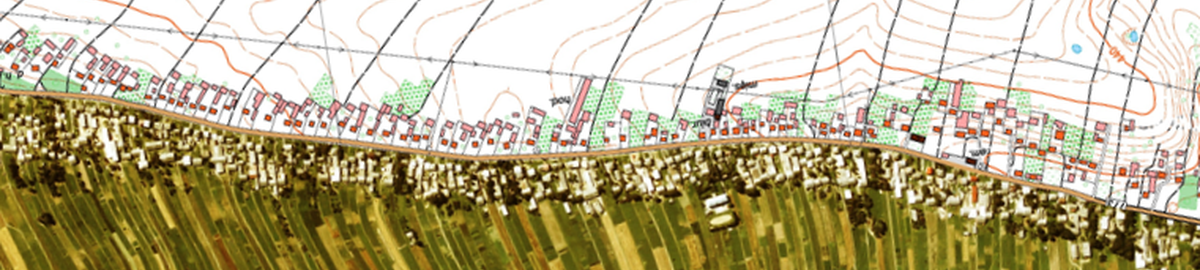
The article presents changes in the manner of representing buildings in the Land and Property Register (EGIB) database based on seven documents constituting the legal foundation for keeping Land and Property Register in Poland in the period of 1955–2018. The scope of the graphic part, the descriptive part including distinguishing the building status, the definitions of the contour and the built-up area, as well as attention to the types of buildings and building registration data were subjected to comparison. For the guidelines as to the building’s contour included in descriptive part, the numerical image of three selected buildings for the 5 analysed time periods has been presented in order to illustrate the changes that have occurred, relating to the graphic part.
Paweł Kotlarz ![]()
Selected aspects of practical projects for property delimitation and resumption of boundary marks, in view of the current legislation in Poland
DOI: http://dx.doi.org/10.15576/GLL/2019.1.33
The aim of this publication is to present, discuss and compare two geodetic-legal procedures in the scope of drawing up a survey report (basic trig data) on two particular geodetic tasks, namely the delimitation (demarcation) of a real estate property, and the resumption (restoration) of boundary marks. The analyses were carried out, based on the current applicable legal acts and relevant implementing rules regarding the surveying activities in question and on the basis of geodetic basic trig data surveys, accepted by the State Geodetic and Cartographic Documentation Centre. The publication presents selected aspects of the discussed works from the point of view of geodetic practice in the field. The author indicates the responsibilities of the authorized (certified) surveyor, and the surveyor’s role in these two different geodesic procedures. The effect of the study is to point to the main differences between the two procedures, the effects of which – both in the field and on the map – are similar. The analysis shows the varied level of difficulty of the discussed surveying tasks in the context of formal and legal stipulations currently existing in Poland. Due to the nature of the subject of this study, the conclusions are of local (Poland-specific) nature, without reference to global solutions.
Agnieszka Wnęk ![]() , Dawid Kudas
, Dawid Kudas ![]() , Jozef Halva
, Jozef Halva
Analysis of changes in land cover structure using ring-shaped polygons of evaluation, on the example of selected areas of Slovakia, Poland and the Czech Republic
DOI: http://dx.doi.org/10.15576/GLL/2019.1.45
The objective of this paper is the assessment of the share of individual land cover categories in centric and ring-shaped evaluation polygons. In the analyses the data from the Corine Land Cover project for 2006 and 2012 were used. These data are available through the Urban Atlas. The basic spatial statistics concerning the land cover categories were determined. As a result of the analyses, information about land cover changes that took place over a period of 6 years was obtained, observed with increasing distance from the assumed reference point. An inference was also made regarding the possibility of determining the changes taking place in selected units in the period of 2006–2012.
Instructions for authors
The second issue, No. 2 (2019)
Tomasz Czempas, Petro Dwulit, Waldemar Krupiński
Possible testing of geodetic equipment using the methods of mathematical statistics
DOI: http://dx.doi.org/10.15576/GLL/2019.2.9
The work presents selected methods of mathematical statistics applied to the examination of the correctness of geodetic equipment operation.
Specifically, measurements made with electronic total stations will be tested using statistical compatibility tests and identity tests of empirical measurement error distributions with the theoretical normal distribution N (0;1).
Keywords: statistical compatibility tests, statistical identity tests, geodetic measurements, error distribution, testing of measurement correctness, statistical hypothesis
Grażyna Gawrońska ![]() , Krzysztof Gawroński
, Krzysztof Gawroński ![]() , Karol Król
, Karol Król ![]() , Hubert Buzowski
, Hubert Buzowski
Environmental impact assessment of a planned construction project — case study of the Tuchów bypass
DOI: http://dx.doi.org/10.15576/GLL/2019.2.21
The objective of the present work is to analyse the environmental impact assessment of the project consisting in the construction of the Tuchów bypass (Tarnów district of the Małopolska Region, Poland) as well as to verify the correctness of the report on the impact of the said project on the environment. The paper presents issues related to environmental impact assessment and a detailed analysis of the impact of the planned project on particular elements of the natural environment, including soil and water conditions, land surface, surface and underground water, atmospheric air, acoustic climate, as well as waste management. The conclusions are based on the results of the research and descriptive analysis. It has been demonstrated that the report on the impact of the Tuchów bypass road construction project on the environment has been prepared correctly, and the investment project in question will not have a negative impact on the environment or human health.
Keywords: impact assessment analysis, road infrastructure, investment in linear infrastructure, environmental protection
Krzysztof Gawroński ![]() , Karol Król
, Karol Król ![]() , Grażyna Gawrońska
, Grażyna Gawrońska ![]() , Natalia Leśniara
, Natalia Leśniara
Spatial diversity of tourism attractiveness of the Nowy Sącz district, using the Wrocław taxonomic method
DOI: http://dx.doi.org/10.15576/GLL/2019.2.37
Designation of areas that are attractive from the point of view of tourism is possible by assessing – among other things – the occurrence of tourist attractions in these areas, which become popular tourist destinations, as well as the presence of tourist infrastructure, which makes it possible to take full advantage of these assets. Such assessment can be made on the basis of statistical data analysis, carried out using taxonomic methods. The purpose of the study is to assess the spatial diversity of tourism attractiveness of the Nowy Sącz district (poviat), including the city of Nowy Sącz. The studies applied zeroed unitarization and Wrocław taxonomic method. It has been demonstrated that the majority of the municipalities in the Nowy Sącz district show similarities in terms of tourist attractiveness (according to the adopted research model).
Keywords: taxonomic methods, typology, ranking, socio-economic development
Volodymyr Hlotov, Myroslava Biala
Constructing the 3D model of a glacier part on the Galindez Island
DOI: http://dx.doi.org/10.15576/GLL/2019.2.55
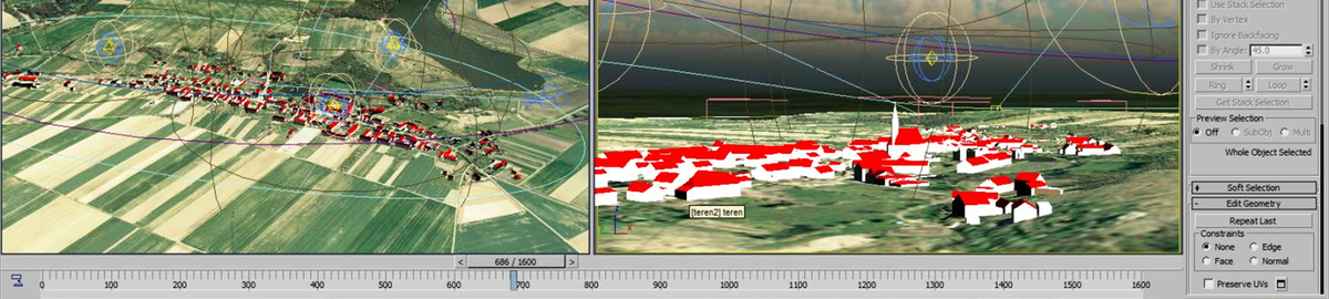
The publication is based on the research carried out at the Ukrainian Polar Station “Academic Vernadsky”, located in the Antarctic region at the Galindez Island. The article establishes relationships between global climate change and changes occurring in the area of Galindez Island based on 3D models of the glacier surface. The article has two parts. The first one reviews software products (AutoCAD, ArcGIS, SketchUp, Digitals) used for three-dimensional surface modeling. We analyze their characteristics, and emphasize the advantages and disadvantages of each program for the purpose of terrestrial 3D modeling. In the second, experimental part of the research, we present 3D models of the glacier surface constructed using various software products. The result of the research presents the obtained model of Galindez Island including all relevant textures and buildings.
Keywords: glacier, digital camera, 3D modelling, GIS, topographical plan
Magdalena Jurkiewicz ![]()
Comparative analysis of selected databases of spatial information systems, with the view to meeting the needs of real estate property valuation in Poland — a case study
DOI: http://dx.doi.org/10.15576/GLL/2019.2.63
This publication is a case study on the analysis of the level of detail of the selected Local Spatial Information System in Poland, in terms of the content of databases and the possibility of using them in property valuation. The scope of research covered in particular the Spatial Information System (SIS) for the city of Częstochowa, operating as part of a project co-financed by the European Union from the European Regional Development Fund under the Regional Operational Program of the Silesia Region for the years 2007–2013. The main purpose of implementing this system is to increase the availability and scope of public services provided electronically, as well as to simplify and speed up administrative procedures. In this publication, we present results of research that was carried out in order to determine the suitability of information collected in the analysed system for the purposes of preparing an appraisal (property valuation) report by a property appraiser. The case study contains a comparative analysis of information available in the Częstochowa spatial information system with similar systems operating in several selected cities. These include the SIS for Kraków, Wrocław and the capital city of Warsaw. Studies have shown that Kraków’s city portal is the most useful in terms of property valuation needs, while the information contained in the Częstochowa spatial information system is not sufficient.
Keywords: spatial information system, property valuation
Przemysław Klapa ![]() , Piotr Bożek
, Piotr Bożek ![]() , Izabela Piech
, Izabela Piech ![]()
Charting topographic maps based on UAV data using the image classification method
DOI: http://dx.doi.org/10.15576/GLL/2019.2.77
A topographic map is a representation of the terrain, its landform and spatial elements present therein. Land surveying and photogrammetric measurements must be conducted in order to produce such cartographic document. The following must be done while obtaining information on topographic objects: determine the character and type of an object or phenomenon; determine the range of its occurrence; indicate a precise location. The next stage involves classification of objects into relevant classes and categories, i.e. arable land, pastures, forests, water basins, technical infrastructure, buildings, and other. Then, the determined classes undergo the process of cartographic generalization by combining smaller elements into a single complex, determination of a common border of their occurrence, and application of relevant graphic symbols and colours.
The measuring technique which provides quick and accurate topographic information about the surrounding area is the one that uses Unmanned Aerial Vehicles (UAV). Digital photographs taken during the flight are the basis for generating a high-quality orthophotomap. Accurate determination of the location of individual spatial elements allows large-scale cartographic documents to be developed. This paper will present the method of charting topographic maps of rural areas based on orthophotomaps made from the photographs taken during the UAV flight. Supervised and unsupervised methods of object classification will be tested in order to increase the effectiveness of determination of types and occurrence range of individual topographic objects, and the obtained results will be used to chart a topographic map of the studied area.
Keywords: topographic map geospatial data, UAV, photogrammetry, large-scale cartographic studies
Katarzyna Kocur-Bera ![]()
Infrastructure investment projects in terms of conformity with domains of sustainable development — a comparative analysis of municipalities in the vicinity of Olsztyn city, in Warmia and Mazury region, Poland
DOI: http://dx.doi.org/10.15576/GLL/2019.2.87
The concept of sustainable development has a number of definitions. In a general sense, it assumes interdependence and equivalence of three domains of reality: environment, society and economy. Harmonisation of the relationship between the society, the economy and the natural environment requires the development of new, more efficient and environmentally-friendly technologies, limiting the exploitation of natural resources, energy consumption, the elimination
of environment-polluting forms of production, as well as a widespread change of the way of life and revision of the acceptable hierarchy of values. According to the valid principles, the investment trends in municipalities should be in line with the domains of sustainable development, thereby providing balance in all the three areas of investment: environmental, economic and social. The aim of the study is to conduct a comparative analysis of the investment projects carried out in the period of 2007–2013 in selected municipalities of the Warmia and Mazury Region for their compliance with the principles of sustainable development of rural areas. Investment projects co-financed from EU funds were examined. This has allowed us to highlight the spheres of investment, which drew particular attention within the period of time under study. The shifted focus of investment efforts also testifies to backwardness in the supported sphere.
Keywords: infrastructural investment projects, sustainable development, EU funds
Karol Król ![]() , Agnieszka Bitner-Fiałkowska
, Agnieszka Bitner-Fiałkowska ![]()
Interactive image viewers — comparison of selected tools and application examples
DOI: http://dx.doi.org/10.15576/GLL/2019.2.97
The tasks carried out by public administration units include information and education. Multiple and direct transmission of information may affect the awareness of local communities. However, public administration units often struggle with the lack of skills in terms of using generally available techniques and design tools that allow relatively easy and low-cost sharing of maps on the Internet. The aim of the present research has been to analyse selected tools that enable interactive presentation of raster maps in the form of an unattended (maintenance-free) web application. Exploratory tests consisted in determining the applicability of selected tools for the presentation of spatial data, as illustrated with the example of land cover analysis of the Wolbrom Municipality (Poland). In conclusion, it was shown that the tested components aspire to be maintenance-free and they serve primarily an information function. They can be used in the presentation of environmental and socio-economic phenomena, as well as infographics or geo-infographics, which require ad hoc publication online.
Keywords: ad-hoc maps, image viewers, online maps, data visualization, interactive tools
Urszula Litwin ![]() , Karolina Misiak
, Karolina Misiak
Modified multi-valued method as an effective way of identifying investment areas, as illustrated with the example of Dobczyce town
DOI: http://dx.doi.org/10.15576/GLL/2019.2.113
The multi-valued method proposed by Walerian Wierzchowski [1996], subsequently modified by U. Litwin and K. Misiak, is a combination of cartographic research methods and mathematical analyses. The proposed technique presented in action can be viewed as a series of feasibility studies, which are the necessary foundation for programming the optimal structure of land use in urban areas.
As exemplified in the collected information, various cartographic studies and existing data about the town of Dobczyce, four possible designated functions have been presented, of which priority was given to the industrial function. The obtained results confirmed the effectiveness of the developed method, its usefulness in the planning practice, while highlighting the synergistic effects of the set objectives.
Keywords: multi-valued method, land planning, technical infrastructure, industrial function
Mateusz Śmigielski, Jacek M. Pijanowski ![]() , Jacek Gniadek
, Jacek Gniadek
Unambiguous determination of point coordinates in the geodetic measurement network when establishing land records
DOI: http://dx.doi.org/10.15576/GLL/2019.2.135
The article discusses the problem of unambiguous determination of the geodetic control network points’ coordinates in the State Geodetic Coordinate System 2000, fixed during works related to the establishment of land records. The solutions and measurement methods applied in this respect, in accordance with the applicable standards, in many cases do not allow the correct identification of the boundary points of land plots in the process of their designation. The
data provided by the district centres of surveying and cartographic documentation (PODGiK) concerning the point coordinates of measurement networks established for the purpose of creating land records in the period following World War II present a lot of problems for geodetic contractors. Due to the lack of unambiguous coordinates of the geodetic network points, undertaking additional work is often required, including the identification of geodetic network points and verifying the compliance of their position in the field, based on the archival data. These are time-consuming activities, and they do not always bring the intended effect. The present article contains the results of the research on the compliance of archival data with the actual location of points in geodetic networks, in several selected precincts of the Świętokrzyskie region. On the basis of the analyses we have carried out, discrepancies were determined within the data constituting the PODGiK resources, and a solution was proposed to obtain coordinates of geodetic network points that could be considered correct.
Keywords: geodetic network, 1942 coordinate system, 1965 coordinate system, 2000 coordinate system, establishing land records, determination of boundary points
Michał Uruszczak
Problems of tourism development of sea-coast zones, as illustrated with the example of Ustka town
DOI: http://dx.doi.org/10.15576/GLL/2019.2.153
The town of Ustka is a health resort located in Central Pomerania, situated within the coastal zone, and serving tourism, agricultural and forest functions in this region of Poland. Spatial development resulting from the immediate vicinity of the sea and related environmental conditions is visible within the space, which is the subject of the present analysis. The fragment of the coastal zone, which functions as the main area of recreation and leisure within the town of Ustka, has been examined. The article presents the analysis of the particular features typifying the local development of the eastern part of the Baltic coast belt in the town of Ustka, as well as its general evaluation, and indication of the possibilities for tourism adaptation of one of the spaces within this area of the discussed town.
In addition, one of the goals of the present work is to draw attention to the landscape-related legal problem of unfinished construction projects, particularly troublesome in places that suffer from the deficit of spaces dedicated to leisure activity. A classic example is the ruin of a hotel in Ustka town, discussed in the present article.
Keywords: Ustka town, tourism development, seaport town, “ghost hotel”
Maria Zbylut-Górska ![]() , Adam Górski
, Adam Górski
The scope of examination of the real estate appraisal report in court of law and in administrative proceedings — selected problems illustrated with the jurisprudence of the supreme court, courts of general jurisdiction, and administrative courts
DOI: http://dx.doi.org/10.15576/GLL/2019.2.165
The article presents considerations regarding the practical problem of the scope of the examination or verification of the real estate appraisal report by the court of justice or by an administrative body.
Based on the analysis of administrative courts’ judgements or decisions, it should be stated that there is no uniform view developed in the jurisprudence of this issue. Various standpoints in this matter can be observed: from the position limiting the possibility of examining the report to formal issues only, to the position allowing the possibility of far-reaching interference with its substantive content (for instance, in the choice of approach, or valuation methods). The judgements of the Supreme Court and common courts demonstrate an approach to the problem allowing free discretionary assessment of evidence, without referring to specific issues regarding the assessment of the content in either substantive (content-related) or formal terms. In the opinion of the present authors, it is necessary to distinguish between the verification of the appraisal report in terms of objective criteria from the examination in the scope of subjective criteria.
Keywords: real estate appraisal report, real estate property appraiser, examination (verification) of the appraisal report
Instructions for authors
The third issue, No. 3 (2019)
Agnieszka Bitner 
![]() , Karol Król
, Karol Król ![]() , Piotr Piotrowski, Sabina Gajczak
, Piotr Piotrowski, Sabina Gajczak
Analysis of generally available online sources of spatial data in the context of appraising historic real estate property
Corresponding author
DOI: http://dx.doi.org/10.15576/GLL/2019.3.7
The paper presents an analysis of generally available (open access) online sources of information – such as geoportals – in order to assess how valuable they are to the work of a real estate property appraiser. As a result of the analysis, it was determined what information is available in geoportals about a specific real estate property, which would be relevant in the valuation process. The property in question is located in the Dolnośląskie (Lower Silesian) region, Średzki district, Środa Śląska municipality. It is a property of a historic-cultural value.
Two nation-wide geoportals were examined, as well as regional and local geoportals from the Lower Silesia region, where the valued object is located. Three categories of geoportal assessment were applied in this study, namely: functionality, transparency, and the availability of information about the valued property; the latter being the most important from the property appraiser’s point of view. The analysis showed that geoportals provide information relevant to the real estate property in the valuation process. The levels of information availability in the studied map portals were shown to have varied. Of course, this kind of information requires verification, because not all portals provide the date and time of the last information update. That notwithstanding, they still constitute valuable sources of information about the real estate property.
Keywords: historic property, geoportal
Szczepan Budkowski , Jacek Gniadek ![]()
Selected problems pertaining to modernisation of land and building records – determinationof boundaries of real estate plots
Corresponding author
DOI: http://dx.doi.org/10.15576/GLL/2019.3.17
In Poland, the land and building records (EGiB) function as real estate cadastre, and are subject to periodic and on-going updating in accordance with applicable regulations. In addition to upgrades aimed at bringing the field status in line with the registration status, land and building records’ modernizations are also being carried out. The purpose of modernization is to improve the quality of collected data as well as their standardization and harmonization. Modernization works can be carried out through field measurements or the use of photogrammetric technology. The purpose of this publication is to clarify the problems associated with determining the boundaries of registration plots in the context of modernization works performed using the photogrammetric method. The paper includes an assessment of technical and legal aspects related to the above-mentioned tasks.
Keywords: EGiB modernization, real estate cadastre, data reliability
Grażyna Gawrońska ![]() , Krzysztof Gawroński
, Krzysztof Gawroński ![]() , Karol Król
, Karol Król ![]() , Katarzyna Gajecka
, Katarzyna Gajecka
Wind farms in Poland – legal and location conditions. The case of Margonin wind farm
Corresponding author
DOI: http://dx.doi.org/10.15576/GLL/2019.3.25
The aim of the present work is to analyse the legal, organizational and location conditions of the wind farm in the Margonin municipality. The Margonin wind farm is the largest environmental investment project in Poland. Wind power plants have been located in two areas, covering an area of over 50 km2 each. The planning procedure was launched in 2007, and the first windmills started their operation in 2009. The investment project implementation procedure was conducted in accordance with the law that was in force at the time. The body conducting the administrative proceedings provided public participation in the process, and the comments submitted by the residents were fully taken into account. In addition, the investor, previously required to carry out the acoustic analysis of the investment project, has silenced some of the station on the basis of the results. Distances from buildings, as well as sites of nature conservation have been preserved. The launch of the largest wind farm in Poland contributed to the improvement of the material situation of the inhabitants of the Margonin municipality as well as the overall functioning of that municipality. Currently, the investor is still actively involved in maintaining the appropriate condition of technical infrastructure.
Keywords: renewable energy, wind energy, wind power plant, local planning, local development
Karol Król ![]() , Agnieszka Bitner
, Agnieszka Bitner ![]()
Impact of raster compression on the performance of a map application
Corresponding author
DOI: http://dx.doi.org/10.15576/GLL/2019.3.41
Raster publications provide one alternative to database-based technologies, and despite their limitations, they may be used in the presentation of data having spatial reference. Image browser performance can have a particular impact on the comfort of its use. The aim of the present work is to analyse the relationships between the degree of raster compression and the performance of the map application. The research was carried out in an informal manner, under conditions of typical use, in the form of ad-hoc tests. The measurement was performed using three applications that automate tests: (1) Cloudinary Website Speed Test Image Analysis Tool, (2) GTmetrix, and (3) Dareboost. It has been shown that in applications based on raster maps, which are of an illustrative, temporary and at the same time ad-hoc nature (ad-hoc maps), maintaining high quality images at the expense of application performance is not justified.
Keywords: WebP files, raster files, performance, website speed, ad-hoc maps
Karol Król ![]()
Geoinformation in the invisible resources of the internet
Corresponding author
DOI: http://dx.doi.org/10.15576/GLL/2019.3.53
The article presents an introduction to deliberations on the type and scope of information, including geoinformation, made available in the Deep Web and Dark Web. It has been shown that geoinformation is present in the Surface Web, although only a small fragment is available in the search results. In the search indexes, the main pages of specialised geoinformation portals, Internet maps and databases are typically made available. Most geoinformation is available on the Deep Web, which requires the use of specialized search engines or exploration of thematic maps. It was also pointed out that geoinformation contradicts the assumptions of the Dark Web. The Tor network, which is the basis of the Dark Web, was created to ensure anonymity and prevent location in space.
Keywords: Surface Web, Deep Web, Dark Web, geoinformation, indexable Web
Klaudia Mazur, Michał Maciąg, Patrycja Pochwatka ![]()
An interactive map of the main bus station in Lublin – travel information system based on geospatial data sources
Corresponding author
DOI: http://dx.doi.org/10.15576/GLL/2019.3.67
The work aimed to create and share for public use an Interactive Map of the Main Bus Station in Lublin, using the base map as a primary data source. This solution may be an alternative to the most popular way of basing on the Google Maps or OpenStreetMap data. The final visualization was prepared by connecting digital geospatial data processing methods with land surveying techniques. The map was designed as an information system for travellers and other people moving through the bus station facility. The intended ‘interactivity’ includes the ability to display proper information about selected objects and choosing preferred viewing parameters, such as the scale or the type of base layer. The final product is an Internet application, created and published using the ArcGIS Online service, in contrast with the majority of similar applications, which are typically developed using Google Maps tools.
Keywords: interactive map, base map, GIS, travel information, Lublin
Robert Muszyński , Katarzyna Kocur-Bera ![]()
Utilitarian attractiveness of agricultural plots – case studies of a complex of plots located in the Szczepankowo village (Warmia and Masuria region)
Corresponding author
DOI: http://dx.doi.org/10.15576/GLL/2019.3.79
The attractiveness of agricultural real estate is affected by a number of factors, of which the most important include: location, convenience of access, utilitarian value, spatial configuration, neighbourhood, agricultural culture, and level of crop difficulty. The attractiveness is related to spatial order. Indicators for the assessment of spatial order can be also used to assess the utilitarian attractiveness. The scope of features also depends on the buyers, i.e. potential users of the land. The aim of the present research was to assess the utilitarian attractiveness of agricultural parcels. The selection of indicators was made on the basis of a literature review and indications from the surveys. The research object was a complex of plots of the village of Szczepankowo located in the Lubawa municipality (Warmia-Masuria region). Each studied plot used for agriculture was assessed in terms of twelve attributes representing spatial order. The results of the assessment are presented in tabular and graphical format. The vast number of plots in the studied complex has favourable attractiveness for agricultural use. Due to the diverse nature of the elements and forms occurring in rural areas, ensuring spatial order in these areas is difficult. The use of the developed indicators provides the opportunity to indicate which of the attributes of the assessed space may have a negative impact on the attractiveness. Indication of elements disturbing spatial order and introducing chaos in space enables carrying out corrective actions, for example, agricultural land management measures that make it possible to influence the spatial structure of agricultural plots.
Keywords: spatial order, rural areas, utilitarian attractiveness of agricultural plots
Agnieszka Ziernicka-Wojtaszek ![]() , Katarzyna Jargieła
, Katarzyna Jargieła
Evaluation of the urban space of Janów Lubelski for the needs of tourism function
Corresponding author
DOI: http://dx.doi.org/10.15576/GLL/2019.3.95
The aim of the present work is the evaluation of Janów Lubelski’s urban space for the needs of tourism function, carried out using the method of point bonitation based on inventory conducted in the field, the analysis of thematic maps available on the geoportal.gov.pl website, as well as of subject literature and strategic documents. The qualities of the natural and anthropogenic environment as well as tourist infrastructure and development were analysed in detail. A survey was conducted among the residents, on the attractiveness of the city space. Based on the city’s valorisation thus conducted, on the indication of the most valuable natural assets, as well as the analysis of strategic documents and survey results, it was found that Janów Lubelski is an attractive destination in terms of tourism development. The Zalew Janowski (Janów Reservoir) is the most attractive and the most developed tourist site in the area.
Keywords: natural and anthropogenic values, tourism development
Iwona Cieślak ![]() , Karol Szuniewicz
, Karol Szuniewicz ![]() , Szymon Czyża
, Szymon Czyża ![]()
Analysis of changes to the landscape in transitional zones of medium-sized cities of central Europe
Corresponding author
DOI: http://dx.doi.org/10.15576/GLL/2019.3.111
The article presents results of an analysis of changes to the landscape in zones directly bordering with Central European cities of medium size. Authors have designated and analysed 57 zones as buffers contained within a radius of 30 km from the administrative city boundaries. Transformations of the landscape were determined on the basis of three indicators showing the fragmentation of the land use forms, distortions of area patches with different land uses, and an increase in the diversification of functions. The data adopted for the study originated from CORINE Land Cover, determined for two points of time i.e. the years 2006 and 2012. The obtained results indicate that the changes to the landscape, identified on the basis of the selected indicators, are strongly linked to the increase in the size of urban areas. The analysis also showed a clear differentiation between cities situated in Central European countries.
Keywords: land use, landscape transformations, GIS analysis, CORINE Land Cover, urbanisation
Instructions for authors
The fourth issue, No. 4 (2019)
Henryk Bryś , Kazimierz Ćmielewski ![]() , Marek Trojanowicz
, Marek Trojanowicz ![]()
Precise integrated hybrid networks in 21st-century tunnel surveying
Corresponding author
DOI: http://dx.doi.org/10.15576/GLL/2019.4.7
The authors in this study briefly outline contemporary trends and the hierarchical construction of the models of surface and underground, horizontal tunnel networks, in the aspect of their optimization, accuracy as well as internal and external reliability. The developed modulartrilateral tunnel network is characterized by the elimination of the influence of temperature field on the measurement results, and also the resulting impact of the negative phenomenon of horizontal refraction occurring in the vicinity of the tunnel walls. Trilateration underground linear network with its specific advantages constitutes an alternative to traditional polygonal structures often used in the implementation of tunnel constructions. Simulation adjustment results and lateral coordinate deviations for the end points of the 10.5 km long network have been presented.
Keywords: tunnel surveying, hierarchical system of network construction, trilateral network, elimination of horizontal refraction
Grażyna Gawrońska ![]() , Krzysztof Gawroński
, Krzysztof Gawroński ![]() , Karol Król
, Karol Król ![]() , Sebastian Ciesielka
, Sebastian Ciesielka
Environmental impact assessment of the Waksmund–Ostrowsko–Łopuszna bypass construction, with particular reference to the results of public consultation process
Corresponding author
DOI: http://dx.doi.org/10.15576/GLL/2019.4.23
The subject of this publication concerns the assessment of the environmental impact of the construction of the bypass road in Waksmund, Ostrowsko and Łopuszna, in the municipality of Nowy Targ. In addition, the article presents the results of the evaluation of public consultation in the procedure for assessing the environmental impact of the discussed project. In order to assess the impact of the planned investment on the environment, the report on the environmental impact of the project and selected legal acts were analysed. It was demonstrated that the report on the environmental impact of the project entitled: “Construction of the Waksmund–Ostrowsko–Łopuszna bypass along regional road No. 969” was implemented correctly. The proposed solutions contained in the report on the environmental impact of the project will eliminate the negative impact of the planned bypass road on the environment, and they will also increase the attractiveness of the pertinent areas from the point of view of residents and prospective investors. The technical solutions adopted along the new road, including roundabouts, will serve to calm the traffic, and improve the safety of drivers and pedestrians.
In order to obtain reliable information about public consultation meetings, an evaluation survey was developed. The survey was conducted in May 2019, and 43 respondents took part in it. The survey results have shown that the public consultation was not properly prepared, which was reflected in the respondents’ opinion. The main reason for the negative reviews was the lack of publicly available information about the consultation. In addition, the low attendance at consultation meetings was noted as a significant problem.
Keywords: impact assessment, the public consultation, bypass road, environmental approval
Józefa Gniewek ![]()
Attempted assessment of the collaboration between cooperative banking sector and the state administration and local self-government institutions in Poland
Corresponding author
DOI: http://dx.doi.org/10.15576/GLL/2019.4.41
In this study, general financial characteristics of the cooperative banking sector in Poland in the years 2010–2018 were discussed, presenting the most important balance sheet data and profit and loss statement information. The focus was also on the analysis and assessment of the importance of state government and local self-government institutions (general government institutions) for cooperative and affiliating banks. An attempt was made to establish the relationship between the receivables of state government and local self-government institutions and the liabilities of these institutions, versus debt and capital instruments broken down into cooperative banks, affiliating banks, and the entire sector.
As a result of the conducted research, it was found that cooperative banks constitute the core of the cooperative banking sector, and that they achieve a better and more stable net financial result; moreover, they systematically increase their balance sheet total – even faster than commercial banks – as well as increasing the size and quality of receivables and maintaining good level of liabilities. Central and local government institutions, although they do not show a large share in the discussed financial figures in the cooperative banking sector, nevertheless play an important role primarily in cooperative banks, but also in affiliating banks.
Keywords: cooperative banking sector, central government and local self-government institutions, analysis of deposits and loans
Marta Gross
Public Real Estate Management Index – a case study of european states
Corresponding author
DOI: http://dx.doi.org/10.15576/GLL/2019.4.51
Public property management should be effective, considering the limited resources that public economies have at their disposal.
The aim of the present article is to develop an integrated indicator – Public Real Estate Management Index (PREMI) – for the analysed countries, and to indicate their relative scores in the ranking, and particularly to indicate their position within Poland’s classification system. The results published by various international organizations were used in order to determine the total PREMI scores.
Keywords: Public Real Estate Management Index, real estate management, public sector
Dawid Kudas ![]() , Agnieszka Wnęk
, Agnieszka Wnęk ![]()
Operation of ASG-EUPOS POZGEO sub-service in the event of failure of reference stations used in the standard solution – case study
Corresponding author
DOI: http://dx.doi.org/10.15576/GLL/2019.4.59
The validation of the work of computational algorithms operating within the positioning system services under unusual measuring conditions is an important part of the entire system. Particularly noteworthy conditions are failures of reference stations forming the examined station network. The article evaluates the operation of the algorithm implemented to the POZGEO sub-service of the ASG-EUPOS system in the event of failure of reference stations used in the standard determination of the coordinates of the selected spatial point. The research material consisted of 117 days of continuous determination of the position of the selected spatial point using 1 hour of GPS static observations. Reports on the procedure of determining the position in the post-processing mode in POZGEO sub-service of static satellite observations were used to simulate the reduction of the number of tie vectors in coordinates’ determination method. The resistance of the automatic post-processing algorithm to failure of parts from the standard reference stations used was assessed.
Keywords: POZGEO, reference station failure, validation, automatic post-processing
Bogusława Kwoczyńska ![]() , Wojciech Sroka
, Wojciech Sroka ![]() , Kamila Sikora
, Kamila Sikora
Analysis of the changes to land use in selected municipalities of Lublin metropolitan area, based on remote sensing data
Corresponding author
DOI: http://dx.doi.org/10.15576/GLL/2019.4.73
The aim of the study was to diagnose the main trends of the changes in land cover around the urban agglomerations, as illustrated with the example of Lublin, over the last twenty years (1998–2016), as well as their statistical and graphical presentation in the form of digital maps compilation. The project was conducted on the basis of the remote sensing data: RapidEye and LANDSAT 5 TM satellite imagery from three temporal records (1998, 2009–11, 2016–17). Detailed research was carried out in purposefully selected municipalities. The performed analyses showed that in the studied municipalities some changes in the use of arable land and grassland occurred. The largest loss in terms of area share was recorded mainly in the arable land. At the core of the metropolitan area, i.e. in the city of Lublin, over the last 20 years the share of arable land in the total area decreased by almost 11 percentage points (p.p.). In the municipalities located directly at the border with Lublin, this loss was much lower, and was equal 4–5 p.p. Slightly larger changes occurred in municipalities located further from the core, where both in the category of very good and slightly weaker natural conditions, losses of arable land were greater than in municipalities located directly at the core’s border of the metropolitan area (MA).
Keywords: satellite imagery, land cover, metropolitan area (MA)
Barbara Prus ![]() , Arkadiusz Nowak
, Arkadiusz Nowak
Historical land use conversion in Kraków’s metropolitan zone
Corresponding author
DOI: http://dx.doi.org/10.15576/GLL/2019.4.93
Land use conversion is a dynamic process that occurs all over the world. The scale of this process is global, and depends on related driving forces. There are numerous case studies of land use changes but only a few synthesise the results.
The aim of the study is to analyse historical land use conversions in two villages located in periurban areas of the city of Kraków, and in particular, to indicate the directions of these changes associated with the distance of the given village to Kraków. The examples of two villages were selected so as to indicate the direction of changes in the immediate vicinity of the city as well as in a zone further outside the city. The aim is also to present a possible approach to monitoring the long-term development of these areas.
As regards Poland, the expansion of urban pattern of land development outside the administrative boundaries of cities results in direct interference in agricultural production space, and not infrequently in areas having particular natural and cultural values. This is also the case within the zone of the direct impact of the city of Kraków on areas located to the south of the urban agglomeration. The article confirms that the changes involve the conversion of agricultural areas into built-up and urbanised areas. Nevertheless, the study results indicate an unexpected increase in the area of wasteland in close vicinity of the city, despite soil conditions being favourable to pursuing agricultural activities. It is a long-term study, which considers precise maps showing land use structure. It is the first step towards designing multi-scale studies that would consider land use changes in the neighbourhood of metropolitan areas.
Keywords: land use changes, metropolitan areas, suburbanisation, agricultural marginalisation, historical GIS
Dawid Kudas ![]() , Agnieszka Wnęk
, Agnieszka Wnęk ![]()
Validation of NRTK measurements with MAC solution in NadowskiNet active geodetic network
Corresponding author
DOI: http://dx.doi.org/10.15576/GLL/2019.4.109
The paper presents an analysis of the accuracy in determining the position of a point using Network Real Time Kinematic (NRTK) method, which applies the MAC solution based on the active network of NadowskiNet reference stations. The object of the study was a 24-hour time series of point coordinates registered with a 30-second recording interval. The collected data were compared with the catalog coordinates of the point. The average values of the mean square errors of X, Y and h coordinates were determined, and their random nature was verified. An analysis was carried out in order to establish whether the distribution of errors obtained remains normal for parameters sufficiently close to the theoretical parameters.
Keywords: NRTK, MAC, NadowskiNet, active geodetic network
Aneta Dacko ![]() , Mariusz Dacko
, Mariusz Dacko ![]()
Size structure of individual farms in Poland between 1918–2018
Corresponding author
DOI: http://dx.doi.org/10.15576/GLL/2019.4.123
This work contains a comparative analysis of the size structure of farms in Poland in three main time frames of the one hundred years since Poland regained statehood, i.e. the interwar period (1918–1939), the period of the People’s Republic of Poland (1945–1989), and the period of the Third Polish Republic (1989–2018). Data sources included statistical yearbooks and literature on the subject. The periods considered in the work were periods of radical changes in the concept of shaping the agricultural sector. In the first period, dominated by the urgent need to rebuild the state and its economy, the development of full-fledged private farms was favoured. In the second period, in the face of changing political and economic conditions, these farms were often forcibly closed down, favouring socialist land ownership. In the third examined period, along with the transformation of the economy, the sector of state-owned agricultural holdings was liquidated. After difficult years of adjusting to the realities of free market economy, agriculture also experienced another change related to Poland’s accession to the EU and functioning under the CAP. However, the research results prove that despite the political and socio-economic changes, and even despite radical political decisions, the farm size structure was characterized by a specific inertia. In the light of statistical data describing the centenary of Independent Poland, one can speak of the sustainability of the size structure of individual farms, demonstrating its high resistance to external factors and stimuli.
Keywords: agriculture, farm size structure, land fragmentation
Magdalena Wilkosz-Mamcarczyk ![]() , Barbara Olczak
, Barbara Olczak ![]()
Parsonage gardens – attempted recreation of historic functional and spatial layouts
Corresponding author
DOI: http://dx.doi.org/10.15576/GLL/2019.4.137
The article is devoted to gardens that were once the property of parsons – in this article, defined as parsonage gardens. They were part of church garden compounds, however, compared to other forms and projects of sacred greenery, they without a doubt attract much less attention. This translates into the fact that this particular term is not used in the literature of the subject, despite the fact that examples of such forms of green spaces can be found in Poland. In the article, we attempt to present parsonage gardens as having both utility and decorative functions, and representing a high degree of harmonization between man-made greenery and the surrounding natural and cultural landscape. The study analysed the shape and layout of such gardens, and their functional and spatial program against the background of the current status of three selected objects from southern Poland, each in a different state of preservation.
Keywords: parsonage gardens, church gardens, utility gardens
Volodymyr Hlotov , Alla Hunina
Study of the method for focal length determination in digital cameras
Corresponding author
DOI: http://dx.doi.org/10.15576/GLL/2019.4.145
The authors analysed the methods for determining the focal length in digital cameras (DC) and proposed a method, the implementation of which is to survey the correct triangular metal prism from the left and right points of the basis. Next, on the stereo pair of digital images obtained from the surveying, the corresponding coordinates of the points on the near and far edges of the prism are measured, and the focal length of the non-metric DC is determined. To test the method, the focal length of the Sony ILCE-7R and Canon EOS 450D cameras was determined. In order to establish the precision parameters of the method, the following parameters were taken into account: determining the accuracy of measurment on the basis of surveying, the accuracy of measuring the heights, the accuracy of calculation of the longitudinal parallax, the accuracy of calculating the difference between the parallaxes.
Keywords: unmanned aerial vehicle, digital non-metric camera, focal length
Bogusława Kwoczyńska ![]()
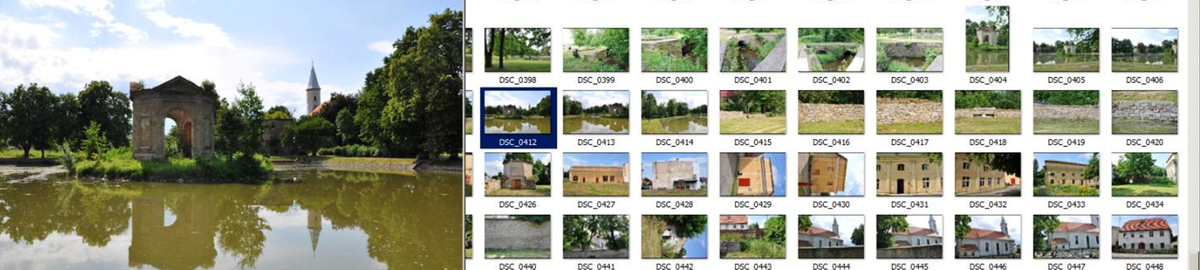
Modelling of a heritage property using a variety of photogrammetric methods
Corresponding author
DOI: http://dx.doi.org/10.15576/GLL/2019.4.155
In recent years, 3D modelling of historic heritage properties is most often based on photogrammetric measurements. Data on such properties can be obtained, however, by a variety of entirely different methods.
This publication presents an example of developing a 3D model of a historic heritage building using two photogrammetric methods. The first one was based on photographs taken with a nonmetric camera, and the second one was based on data from terrestrial laser scanning.
The object of the study was the Museum of the Estreicher Family in Krakow. The photos were obtained with a Canon EOS 400D DSLR camera and a cloud of points from terrestrial laser scanning with a Leica ScanStation P40 scanner. The development of the 3D model based on photographs was carried out using the Bentley ContextCapture software application, and the Agisoft PhotoScan Professional. In contrast, TLS (Terrestrial Laser Scanning) data was processed in the Leica Cyclone software application and modelled in the 3DReshaper. Both methods were analysed and compared in a tabular presentation.
Keywords: 3D model, terrestrial laser scanning, non-metric imaging
Karol Król ![]()
Map charts: visualisation of statistical data on a background map – case study
Corresponding author
DOI: http://dx.doi.org/10.15576/GLL/2019.4.171
Data visualizations take a variety of forms, from classic bar charts to three-dimensional presentations on globe maps. The purpose of this paper is a comparative analysis of selected techniques for visualizing statistical data on a background map. The exploratory tests were carried out to study the design possibilities of three software tools: Visualization: GeoChart, GIS and JavaScript and 3D Maps (MS Office), as well as the functionality and usability of applications created with them. In addition, selected technical attributes of the applications were measured, including the size and number of component files, loading time in the web browser window, as well as performance. It has been shown that the tested tools are predisposed to create data visualizations on administrative maps, that they have different design possibilities, that they differ in the degree of service advancement, and that they can also be useful in creating small visualizations, so-called “ad-hoc map”.
Keywords: data visualization, geovisualization, online maps, ad-hoc maps, mashups
Krzysztof Gawroński ![]() , Karol Król
, Karol Król ![]() , Grażyna Gawrońska
, Grażyna Gawrońska ![]() , Bartosz Kubicki
, Bartosz Kubicki
Analysis of the development of Lublin city bike stations versus the economic and spatial conditions in that city
Corresponding author
DOI: http://dx.doi.org/10.15576/GLL/2019.4.183
The analysis covered the city bike rental system in Lublin and the development of the so-called Lublin City Bike (LRM) network. The LRM network was chosen due to its dynamic development, because Lublin has the most city bikes per capita in Poland. LRM was launched in June 2014. Since then, the Lublin City Bike consists of 951 bikes located in 97 rental stations in Lublin and Świdnik. The purpose of the present work is to analyse the development of city bike docking stations in Lublin against the background of economic and spatial conditions of the city. The analyses were performed using GIS software. The greatest interest in LRM was recorded in the central part of the city. It has been shown that the development of cycling infrastructure does not have a significant impact on the spatial coverage of Lublin City Bike. Developments planned until 2022 will also not significantly affect the extension of LRM coverage, as they are focused on increasing the density of stations. Furthermore, the location of the LRM stations is not related to the population density in individual city districts.
Keywords: city bike, city bike docking stations, public transport, spatial analysis, cartographic visualization
Robert Gradka ![]() , Roksana Majdańska, Andrzej Kwinta
, Roksana Majdańska, Andrzej Kwinta ![]()
Example of historic building inventory with an application of UAV photogrammetry
Corresponding author
DOI: http://dx.doi.org/10.15576/GLL/2019.4.201
The purpose of this work was to develop data from photogrammetric flight using an UAV with a non-metric camera. Due to the specific subject of the present study, it was necessary to review the software available on the market, one that would provide the opportunity to model specific objects such as architectural structures, with satisfactory results. As a result, a 3D model of the eastern façade of the church of Saint Charles Borromeo in Wrocław was obtained. The use of UAVs for this type of measurement is an innovative method that allows quick, secure and relatively cheap data acquisition. The article presents subsequent steps in the development of non-metric photogrammetric data. The model obtained from photographs taken by the UAV was subjected to accuracy analysis using a tachymetric measurement fitted into this model. Equipping the model with georeferencing consisted in determining coordinates of characteristic points, thanks to which it was placed in the local coordinate system.
Keywords: 3D modeling, AgiSoft, UAV
Bogusław Michalec ![]() , Mateusz Strutyński
, Mateusz Strutyński ![]()
Silting forecast of the planned retention reservoirs within the drainage system in Łączany
Corresponding author
DOI: http://dx.doi.org/10.15576/GLL/2019.4.219
This paper presents the concept for the location of two dry water reservoirs designed to retain water led through the main ditch (R) of the drainage system in Łączany. The purpose of the work is to develop a forecast for the reduction in the capacity of planned dry water reservoirs. Planned water reservoirs will allow increasing flood protection of drained areas. Based on geodetic measurements in the selected locations, the capacity of planned dry reservoirs was determined, amounting to 4.08 and 115.49 thousand m3, respectively for the U reservoir formed from the flood relief channel, and the R reservoir, located in the lower course of the R ditch. According to the developed forecast, applying the Gončarov formula, the U reservoir would be 50% silted after 134 years, and the R reservoir would be 50% silted after 149 years. The forecast has been prepared using the method recommended by the guidelines, i.e. it was developed as for reservoirs with constant water damming (accumulation). TE values determined using the Churchill method were adopted in the silting forecast. The estimated forecast indicates a long service life of the reservoirs without the need for their desilting. However, the development of a detailed forecast would require a modification of the calculation methodology, taking into account the determination of the capacity of water reservoirs to retain bed load, typical of dry water reservoirs. In the absence of the method, determination of the service life cycle of water reservoirs can be developed as an estimate.
Keywords: drainage system, dry water reservoir, bed load transport, silting forecast
Bartłomiej Mikołajczyk , Bogusław Michalec ![]() , Mateusz Strutyński
, Mateusz Strutyński ![]()
Preliminary assessment of the impact of Wrocławski bridge in GLiwice on flood flow in Kłodnica river
Corresponding author
DOI: http://dx.doi.org/10.15576/GLL/2019.4.231
In this work, a preliminary assessment has been made of the impact that the bridge along Wrocławska and Częstochowska streets has on the conditions of flood flow. Calculations were made for a flow with a probability of exceedance p = 1% amounting to 100 m3 · s–1. Based on the field tests performed in the designated section of the Kłodnica river from km 49 + 799 to km 49 + 739, i.e. geodetic measurements of the Kłodnica riverbed and technical inventory of the analysed bridge object, a digital terrain model (NMT) was developed, followed by hydraulic calculations of the water flow Q1% and the flow accumulation (damming) in the clear span of the Wrocławski bridge. The accumulation height was calculated using the formula given in the study by Bajkowski et al. [2000]. Calculations of the accumulation height of designed flow in the clear span of the bridge were also made using the HEC-RAS program. The calculations were made in two variants – in the first variant, calculations were performed for the selected section of Kłodnica without a bridge, and in the second variant, with the bridge. The so-called clear span reserve (bridge clearance) was also calculated, computed as the difference in ordinates of the keystone arch of the bridge span and the stacked water table of the design flow in the bridge clear span. The obtained calculation results indicate no risk of Q1% flow accumulation in the crosssection of the Wrocławski bridge. The calculated accumulation of the design flow will not cause flooding from the Kłodnica riverbed. Preliminary conclusions indicate a possible necessity to verify flood hazard zones for the flow with a probability of exceedance p = 1%, developed for the Kłodnica river in the centre of Gliwice town, developed as part of the ISOK project.
Keywords: flood hazard, bridge, accumulation (damming) height, HEC-RAS
Volodymyr Mikołajowicz Hlotov , Yulia Pariichuk
3D modelling of the territory of the Ukrainian antarctic station “Academician Vernadsky” based on large-scale topographical research
Corresponding author
DOI: http://dx.doi.org/10.15576/GLL/2019.4.243
A number of software products that provide the possibility of 3D modelling are analysed. As a result of the analysis, the advantages and disadvantages of each of those were identified and the optimum product for research implementation was selected. Also, a 3D model of the large-scale topographical map of the Ukrainian Antarctic station “Academician Vernadsky” was developed with the aid of Surfer software application.
Keywords: 3D-model, 3D-modelling
Instructions for authors
Owner of the Journal
University of Agriculture in Krakow
Faculty of Environmental Engineering and Land Surveying
Balicka st., no. 253a, 30-198 Krakow, Poland
phone: +48 12 662 45 32, fax +48 12 662 45 03
e-mail: gll@urk.edu.pl
Publisher
Publishing House of the University of Agriculture in Krakow
29 Listopada av., no 46, 31-425 Kraków, Poland
phone: +48 12 662 51 51, fax +48 12 662 51 59
e-mail: wydawnictwo@urk.edu.pl
e-mail: iwona.pisiewicz@urk.edu.pl