


The fourth issue, No. 4

Dawid Bedla 
![]() , Wiktor Halecki
, Wiktor Halecki ![]()
The use of web application in monitoring the effects of introducing of lower meadows in Kraków’s city parks
Corresponding author
DOI: http://dx.doi.org/10.15576/GLL/2020.4.7
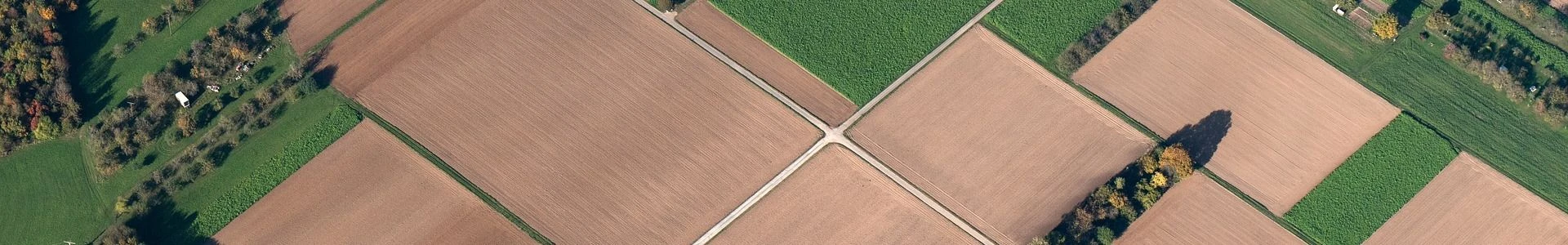
Flower meadows provide opportunities for parks in city centres. Urban green areas combine elements of both natural and human origin, such as planning projects of management entities of green areas. Usually, these parks are compact and easy to separate, with objects intended for active and passive recreation, fully utilising the surroundings. On the basis of available planning documents and maps, the number, size and quality of green areas, including flower meadows in city parks, were determined. By examining the parks’ functional and spatial structure, it is possible to identify the areas in vicinity of which they are located, as well as their purpose and nature. A web application could raise awareness of the role and importance of flower meadows in city parks as an element of public space. For this reason it is currently very important to preserve green areas by surveying the plant structure and dominant phytocoenoses, creating natural maps that present and collect data on the richness of green areas. When analysing the distribution of selected types of city parks, it is possible to observe the dependence of their location to the central parts of cities. The web application presents the distribution of green areas in the urban planning. The application will allow collecting data, which can enable creating a green infrastructure of the Kraków city centre and suburbs, and in the future to show eco-urban aspects in a cartographic form. In the next phase, the application will be extended to a description of the species of meadow plants occurring in city parks. It will not only add didactic elements to the urbanscape, but will also allow for conducting natural field activities, linking garden premises with the surroundings and using local plants.
Keywords: urban ecology • internet cartography • city landscape management • green areas planning
Szczepan Budkowski
Multidimensional cadastre as an element of participation in modern space management
Corresponding author
DOI: http://dx.doi.org/10.15576/GLL/2020.4.17
Rapid economic and social development over the last decade has led to many changes in the way space is managed. The dynamically developing cities, complex infrastructure, vertical spatial division, as well as overlapping ownership rights (in 2D terms) resulted in an increase in the demand for the creation of modern space management systems. The aim of the work is an attempt to answer the question concerning the possibility of using a modern real estate cadastre system. The research method used is case study. The method was supported by an analysis of the literature in the field of land and building records and the use of GIS tools in network analyses. The subject of research is the use of data on building interiors. The task was carried out using the available GIS tools. The method of utilising graphic data presented in this article goes beyond the current cadastre functions and can be used, for example, to find a way inside a building.
Keywords: land and building records • multidimensional cadastre • augmented reality
Dawid Kudas ![]() , Agnieszka Wnęk
, Agnieszka Wnęk ![]()
NRTK measurements with FKP correction method in the subservice NawGeo of ASG-EUPOS
Corresponding author
DOI: http://dx.doi.org/10.15576/GLL/2020.4.27
The paper presents the analysis of the accuracy and repeatability of determining the position of the point by the Network Real Time Kinematic (NRTK) technique using the Flächenkorrekturparameter (FKP) concept. The measurement was based on the Active Geodetic Network – European Position Determination System (ASG-EUPOS). The FKP together with Virtual Reference Station (VRS) and Master Auxiliary Concept (MAC) is the currently available method of generating corrections in NRTK technique in NAWGEO sub-service of ASGEUPOS. NRTK positioning using FKP was analysed based on Global Positioning System (GPS) and Globalnaya Navigatsionnaya Sputnikovaya Sistema (GLONASS) signals, because the combination of these satellite systems is currently a common standard. The subject of the study was a 24-hour coordinate time series with a sampling interval of 30 seconds. The collected data was compared with the precise coordinates of the measuring point by calculating the linear deviations and the mean values of X, Y and Z coordinates’ errors and mean position errors for one-hour periods. Selected measures of positioning accuracy were determined, both for threedimensional and horizontal coordinates. An analysis of selected dilution of precision (DOP) factors was also carried out. The analyses were also carried out for coordinates expressed in the horizontal coordinate system and normal heights in force in Poland due to the assessment of the suitability of FKP for geodetic measurements. The experiment showed the expediency of NRTK measurements using FKP corrections generated based on observations from the ASG-EUPOS network for determining real-time position within the territory of Poland.
Keywords: NRTK • FKP • ASG-EUPOS • active geodetic network • NAWGEO
Andrzej Kwinta ![]() , Joanna Bac-Bronowicz
, Joanna Bac-Bronowicz ![]()
Regular polygons in 2D objects shape description
Corresponding author
DOI: http://dx.doi.org/10.15576/GLL/2020.4.43
Many real 3D objects have complex geometric shapes in various types of analyses. Image of these objects is recorded in the form of a 2D map. In the analysis, a simplification of this image to basic 2D figures with defined geometry is often needed. The paper presents an analysis of the geometry of a flat image (an image of a 3D object) using regular polygons. Geometry properties (F form, C centroid, S size) were determined to describe the object. Various criteria of selection of the ‘best’ regular n-sided polygon for a given 2D object (solved theoretically) were put forward. In the paper, criteria for describing a 2D object by regular n-sided polygons were defined on the basis of determining the measure of object shape elongation (e). In the ‘blind’ theoretical example, it was tested whether the individual shape measures listed in the paper allow for correct identification of the shapes of given 2D objects. The practical application of measures is illustrated by two actual examples. While in the first example the shape of the Canary Islands is analysed, the second example describes the shape of Poland’s borders. Actual examples deliver different results for different measures. In effect, there is no clear objective criterion for selecting a polygon shape. The simplifications of the shape of an object presented in the paper should not be equated with the object's generalization. Such simplifications are used in GIS to visualize geographic analyses based on the data available in the primary database, because the object will retain the character of the shape in the simplest possible geometry and neighborhood, and does not lose any of the scope and accuracy of the attributes assigned to a given object in the database.
Keywords: GIS • polygon geometry analysis • regular polygon • geometric object simplification
Bogusław Michalec ![]() , Stanisław Lubowicz
, Stanisław Lubowicz
Assessment of the impact of small bridges on the ditch capacity of the drainage system
Corresponding author
DOI: http://dx.doi.org/10.15576/GLL/2020.4.63
The objective of the present study was to determine the impact of two small bridges located within the main ‘R’ ditch of the Łączany drainage system on the capacity of the selected fragment of this ditch. A fragment of the ‘R’ ditch was selected for the study, 311.7 m long, with two small bridges (bridge No. 1 at km 3 + 455 and bridge No. 2 at km 3 + 365) and 11 crosssections. Having conducted hydraulic calculations, the capacity of the selected fragment of the ditch was ascertained, assuming the base flow (reliable discharge) determined in the detailed design of the drainage system. The base flow, amounting to 9.77 m3 • s–1, was also used to determine water damming in the examined bridges in accordance with the Regulation by the Minister of Transport and Maritime Economy. As a result of geodetic measurements, changes in the shape of the cross-sections of the ditch and changes to the bottom slope within the tested segment of the ditch were found. It was established that under the conditions of proper maintenance of the ditch, its capacity is not lower than the base flow. However, if the maintenance is neglected, the area before bridge No. 1 will be flooded, which is the result of the lowered capacity of the ditch. It was also found that the examined bridges did not contribute to the deterioration of the conditions of the base flow water through the ditch in the analysed fragment thereof.
Keywords: damming • small bridge • base flow (reliable discharge) • capacity • drainage system
Dawid Kudas ![]()
Analysis of the density of the national network of reference stations on the example of ASG-EUPOS
Corresponding author
DOI: http://dx.doi.org/10.15576/GLL/2020.4.77
Networks of reference stations play the role of sensors networks that continuously receive satellite signals. In this way, they provide data for many issues related to relative positioning. The density of reference stations network has an impact on measurements with kinematic techniques (e.g. RTK, NRTK) and the postprocessing of satellite observations recorded using the static technique. Networks of reference stations are divided according to their spatial range and the tasks they perform. The reference network can also be characterized by the network density. This article presents considerations concerning the determination of the average distance between the stations of national reference network, as well as between the stations of the higher accuracy network and the considered national network. The considerations relate to the example of the Polish ASG-EUPOS network. The average distance between the ASG-EUPOS network stations was determined in two-dimensional (2D) and three-dimensional (3D) space. It was determined that the average 3D distance between neighbouring ASG-EUPOS stations is approx. 42 km. However, in the case of determining the average distance between the network points using the sides of Delaunay triangles, this value is approx. 70 km. In the case of averaging the distance to six closest neighbours of each station, the obtained value was approx. 69 km. The areas of the ASG-EUPOS network characterized by an inconvenient location in relation to the EUREF Permanent GNSS Network class A stations, which is a network of a higher accuracy class, to which the ASG-EUPOS is related, were also indicated.
Keywords: EPN • ASG-EUPOS’s NNI • tie vector length • basis vector
Instructions to authors